HERE HD to XODR (H2O)
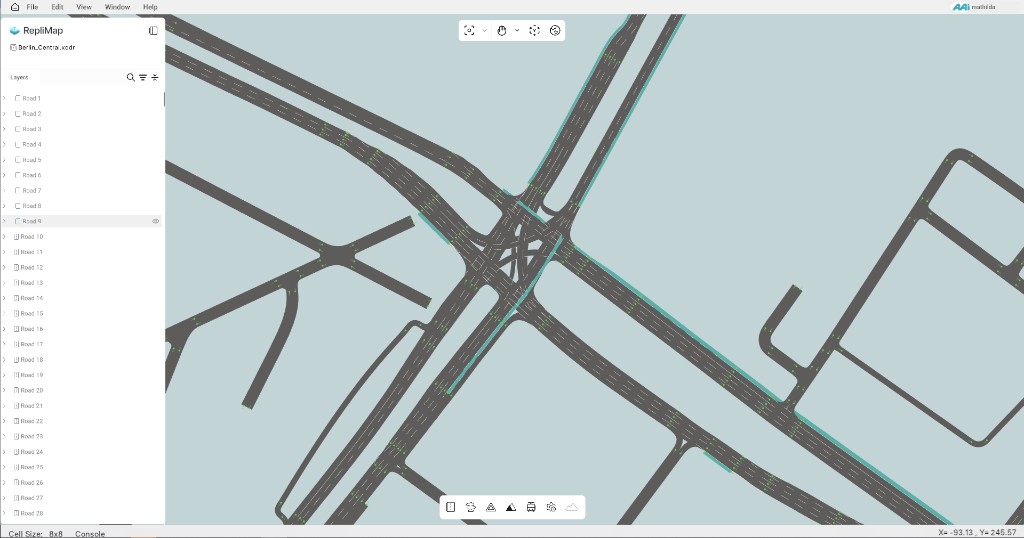
The HERE HD to XODR (H2O) pipeline converts HERE HD Live Maps source data into ASAM OpenDRIVE (.xodr) format for use in RepliMap.
The pipeline:
- Supports HERE HD Live Maps as the input source.
- Converts road geometry and traffic sign layers, including elevation information in the generated road model.
- Generates a corresponding HERE HD Data (
.geojson) file in the WGS 84 Coordinate Reference System (CRS) during the conversion process. - Is designed to be extended with additional HERE data layers in future versions.
HERE HD Data (GeoJSON)
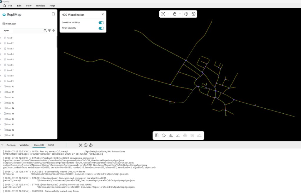
In addition to the OpenDRIVE map, the pipeline generates a HERE HD Data (.geojson) file in the WGS 84 CRS that represents the converted HERE HD map data.
Output Files
| File | Description |
|---|---|
.xodr |
ASAM OpenDRIVE map generated from the HERE HD Live Maps data. |
.geojson |
HERE HD Data in the WGS 84 CRS, generated alongside the OpenDRIVE map. This file can be used for visualization and as input to the GeoJSON to OpenDRIVE (G2O) pipeline. |
Output Location
Both the .xodr and .geojson files are saved in the same output directory specified for the conversion.
Note
The generated HERE HD Data (.geojson) uses the WGS 84 Coordinate Reference System (CRS).
Credentials and coverage required
RepliMap does not include default HERE licenses or API keys.
You must provide valid HERE credentials and ensure your account has area coverage for the region you want to convert.
Before You Run Conversion
Prepare the following:
- HERE credentials (API/user/client/access keys required by your deployment).
- Area definition in GeoJSON (WGS 84) for the region to convert.
- Output folder where RepliMap should write the generated map files.
You can create the area polygon quickly with geojson.io and save it as a .geojson file in WGS 84.
How It Works
In the conversion flow:
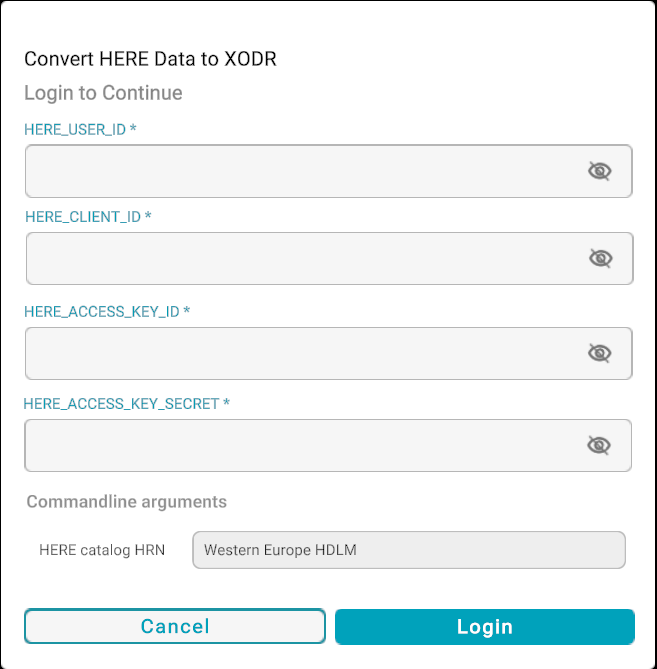
- Enter your HERE credentials.
- Select the input
.geojsonarea file (WGS 84 CRS). - Select the output folder for converted map data.
- Start conversion.
RepliMap then fetches HERE data for the selected bounds, runs conversion, and applies internal geometry optimization/fixes.
Conversion Behavior and Quality Notes
- Conversion can take time because it includes data fetch, conversion, and post-processing.
- The map output on the main canvas is fully automated (no manual intervention required during generation).
- Generated maps may still contain minor imperfections (for example small mesh overlaps or local gaps).
- The pipeline aims for continuous drivable geometry, but some errors are expected depending on source data and bounds.
After conversion, the map is loaded directly into the canvas. You can then use RepliMap tools to review, fix, and further enhance roads, signs, and other elements.
Here-to-ODR Console — Log Export
The Here-to-ODR conversion console provides a dedicated logging panel that records the complete conversion workflow. It helps users analyze processing behavior, detect lagging issues, and review system activity during conversion.
Users can export the log file using the Right Arrow icon available in the console panel. This generates a text-based log file, and the user can select the desired location for saving it.
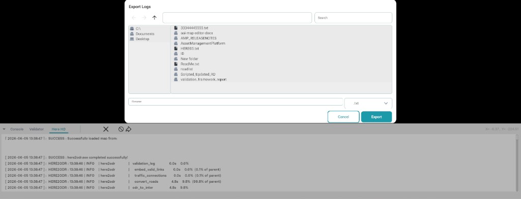
The export process also displays:
- Total processing time consumed during conversion
- Export completion status
Log Content Included in Export
The exported log file contains the following key sections:
| Logs | Description |
|---|---|
| Pipeline Logs | Records step-by-step execution of the conversion pipeline, showing the processing flow and intermediate stages. |
| Profile Report Logs | Contains detailed profile-level information, including execution tracking and reference to the profile report path. The related JSON files can be accessed from this path. |
| Warning Logs | Displays system warnings generated during conversion, helping identify potential issues or irregular behavior. |
Additional Export Information
Includes supplementary details such as:
- Profile report path stored in a reference text file within the exported log, used to locate detailed JSON-based logs.
- Authentication credentials status shown at the end of the exported log file for verification purposes.
File Handling & Naming Behavior
Users must use a unique GeoJSON file name during conversion (including the generated HERE HD Data .geojson in WGS 84).
If a file with the same name already exists in the selected export folder:
- The system will automatically overwrite the existing file.
- It is recommended to avoid duplicate naming to prevent accidental data replacement.
Notes
- Log export is intended for debugging, validation, and performance analysis.
- It is recommended to review logs when:
- Conversion is slow or lagging
- Unexpected warnings or issues occur
- Always verify the export location before saving the file.
- Maintain unique file names for each conversion to ensure data integrity.
Related
- Data sources overview — where the pipeline sits in the reference-data workflow.
- GeoJSON — preparing area bounds for conversion (WGS 84).
- GeoJSON to XODR (G2O) — convert road-network GeoJSON (WGS 84) into OpenDRIVE (
.xodr). - Road tool — refining the generated map after import.