LiDAR Point Cloud Data
LiDAR point cloud data is a 3D dataset captured using a LiDAR (Light Detection and Ranging) sensor. It represents real-world surfaces as a dense collection of spatial points.
Each point may include:
- X, Y, Z coordinates (3D position)
- Intensity (surface reflectivity)
- Optional classification (ground, building, vegetation, objects)
How to Import LiDAR Point Cloud Data
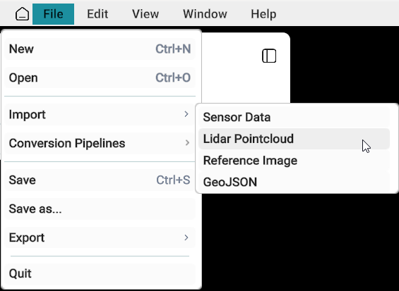
- Go to the File menu from the menu bar.
- Click Import from the dropdown list.
- Select LiDAR Point Cloud from the import options.
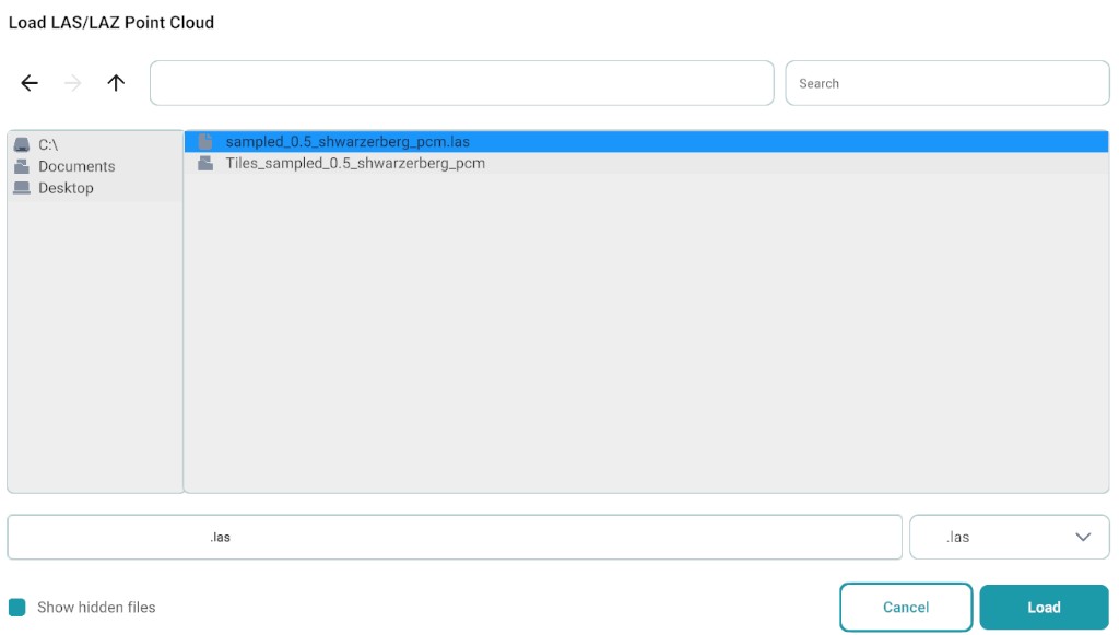
An import window will appear:
- Select the location of the
.lasfile. - Choose the file format (.las / .laz) from the format dropdown (bottom-right side).
- Click Load.
Load LAS/LAZ Point Cloud import window
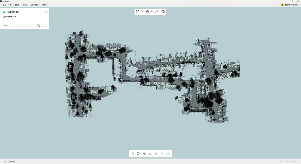
After loading, the LiDAR point cloud will open in the workspace.
Warnings
Warning
- LiDAR point cloud may not be visible in Translucent View.
- Use Light Theme for proper visibility of point data.
- Do not interrupt the import process while data is being loaded.
Recommended Workflow (with Other Reference Data)
If importing multiple datasets together, follow this order:
- Load existing map (if available)
- Import LiDAR Point Cloud Data
- Import GeoJSON Data
- Import GeoTIFF (TIF) Reference Image
All datasets will align correctly only if they share the same coordinate system.
Recommended Verification
Note
After import:
- Verify LiDAR point cloud aligns with the road network
- Ensure consistency with GeoJSON features
- Confirm correct spatial relationship with reference imagery
- Validate overall layer overlap before editing
Related
- Sensor data — camera imagery, trajectory, and combined sensor folder workflows.
- GeoJSON — vector reference layers aligned with point cloud data.
- Reference Image — raster backdrop for spatial verification.
- HERE HD to XODR (H2O) — conversion pipelines after reference data is loaded.